Route Description
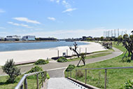
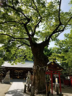
Umeyashiki Sta.→Tsuruwatari Park→Myodenji Temple→Hieda-jinja Shrine→Tsubaki-jinja Shrine→Seiseki Kamata Umeyashiki Park→Kitano-jinja Shrine→Meotobashi Shinsui Park→Danjo Bridge→Myoanji Temple/Kamata Hachiman-jinja Shrine→Keihin Kamata Park→Shochiku Bridge (Aroma Square)→JR Kamata Sta.
The Kamata district is one of Ota City's central areas; National Route 15, National Route 1, and Keikyu and JR lines run through it north to south; Kanpachi-dori Ave. and Tokyu lines pass through east to west. People used to say “trends come from Kamata,” and it was also the birthplace of many movie starts and hit works. Mixing the diverse atmospheres of bustling commercial areas, quiet residential neighborhoods, and historic sites, Kamata is a place you'll want to take your time and enjoy.
* These are estimates given for a person, weight 60kg, moving at 4km per hour, walking 10 min.=30kcal, one step=70cm. The time required in parentheses is the amount of time it actually took members of the collaborating organization to walk the course.
(4.14MB)
* This course is included on P.22 - 23 of the PDF Walking Map.
* Some details in the PDF walking map may differ from Google Map.
* Contact regarding the PDF walking map offered on this website.
[Ota City Health Promotion programs Department Health Care Management Division TEL 03-5744-1683]