Route Description
Nagayama Sta.→Uryu Ryokuchi→Nagayama Daiyon Park→Sakimori Mikaeri Path Marker→Suwa-minami Park→Suwa Daisan Park→Nagayama Sta.
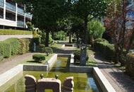
This 5.2-km course to work your legs tours the ponds from Nagayama Sakura-dori Ave. to Uryu Ryokuchi, the single Japanese elm tree in the Nagayama Daiyon Park, and goes up and down the hilly Sakimori Mikaeri path.
* These are estimates given for a person, weight 60kg, moving at 4km per hour, walking 10 min.=30kcal, one step=70cm.
(0.69MB)
* Some details in the PDF walking map may differ from Google Map.
* Contact regarding the PDF walking map offered on this website.
[Tama City Health Promotion Section Tel 042-376-9139]