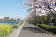
Route Description
Aomonoyokocho Station (Keikyu Railway) → Kurayami-Saka Slope → Yashio Bridge → Keihin-Unga-Ryokudo Park → Shinagawa Seaside → Aomonoyokocho Station (Keikyu Railway)
The name of Sendai-saka (slope) is believed to have originated from the fact that there was a shimoyashiki (suburban residence of feudal lord) of Date Mutsunokami (a feudal load) from Sendai clan near this slope.
* For an estimation of the time required, calorie burned and number of steps to take each course above is calculated using the following conditions: speed of walking is 4km/h, Calorie burned in 10 minutes of walking = 30kcal, 1 step = 70cm (27.5 inch), average weight= 60kg (132.7lbs). Therefore, some estimations may be different from indicated on the Shinagawa Ward Walking Map (PDF).
(602KB)
* Some details in the PDF walking map may differ from Google Map.
* Contact regarding the PDF walking map offered on this website.
[Shinagawa City Healthy promotion department health section TEL 03-5742-6746]