Route Description
Omaru Park→Habitat where silk trees and Japanese dogtooth violets grow in clusters→Shiroyama Park→In front of Sanwa→Inagi Chuo Park Baseball Field→Koyodai 1-chome Intersection→Hitsujisan Park→Omatonotsunoten-jinja Shrine→Omaru Park
On the route from Omaru Park to Koyodai, various trees and plants such as plum trees, Japanese dogtooth violets, Yamazakura cherry trees, and silk trees add color within the park.
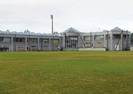
During the 2013 National Sports Festival in Tokyo, the rubber-ball baseball games were held at the baseball field of Inagi Chuo Park located on the route.
* These are estimates given for a person, weight 60kg, moving at 4km per hour, walking 10 min.=30kcal, one step=70cm.
Besides, the time allowed is the actual time when we walked the course.
(1.20MB)
* Some details in the PDF walking map may differ from Google Map.
* Contact regarding the PDF walking map offered on this website.
[Inagi City Citizen Department Sports Promotion Section TEL 042-378-2111]