Route Description
Seishonen Center Iriguchi Bus Stop→Boardwalk→Ochisawa Youth Center→Mt. Kusato→Kusato-toge Mountain Pass→Riverhead of the Sakai River→Seishonen Center Iriguchi Bus Stop
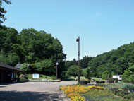
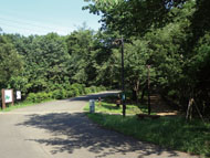
Ochisawa, located on the western edge of Machida City, is an area surrounded by the nature. On this course, you will visit places such as Mt. Kusato, the highest point of Machida City, and the place where the Sakai River begins while enjoying forest bathing mainly on the hiking course around Ochisawa Youth Center.
There are many unpaved roads and steep slopes, so watch your step and enjoy walking at your own pace.
* These are estimates given for a person, weight 60kg, moving at 4km per hour, walking 10 min.=30kcal, one step=70cm.
(1.03MB)
* Some details in the PDF walking map may differ from Google Map.
* Contact regarding the PDF walking map offered on this website.
[Machida City Health Center Health Promotion Dept. TEL 042-724-4236]