Route Description
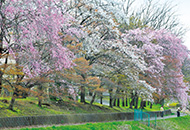
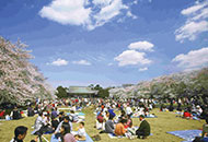
Higashi-koganei Station→Yokuonkan Park→Shinzo-in Temple→Koganei Park→Tama River Aqueduct→Ojusesshu Monument→Scenic Spot Koganei (Cherry blossom)→Ichikishima Shrine→Higashi-koganei Station
* These are estimates given for a person, weight 60kg, moving at 4km per hour, walking 10 min.=30kcal, one step=70cm.
(10.7MB)
*These courses are listed on P.2 of the PDF Walking Map.
* Some details in the PDF walking map may differ from Google Map.
* Contact regarding the PDF walking map offered on this website.
[Koganei City Health and Welfare Department Health Division TEL: 042-346-3700]