Route Description
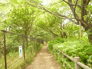
Musashi-Sunagawa Sta.→Sunagawa Bunsui→Tomoegashi Riverbank Site (Tamagawa Aqueduct)→Mt. Konpirayama and Konpira-jinja Shrine and Akiba-jinja Shrine→Sunagawa Learning Center→Cornerstone of Peace→Chuo Nanboku Line→Tachikawa City Hall→National Institute of Polar Research→Takamatsu Sta.
* These are estimates given for a person, weight 60kg, moving at 4km per hour, walking 10 min.=30kcal, one step=70cm.
(0.50MB)
* Some details in the PDF walking map may differ from Google Map.
* Contact regarding the PDF walking map offered on this website.
[Tachikawa City Welfare and Health Department Health Promotion Division Tel 042-527-3272]