Route Description
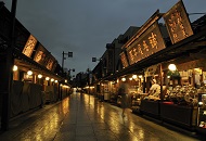
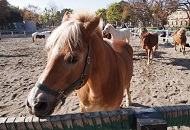
Tobu Bus [Ari 26.27] "Nishi Mizumoto 1-chome" Bus Stop→Anfuku-ji (Yugaokannon) Temple →Pony School Katsushika→Mizumoto Sports Center Park→Katori-jinja Shrine→Cherry Blossoms on the Banks of Mizumoto→Mizumoto Kawasemi-no-sato→Mizumoto-jinja Shrine→Tobu Bus [Ari 26.27] "Mizumoto Tokubetsu Shien Gakko-mae" Bus Stop
* These are estimates given for a person, weight 60kg, moving at 4km per hour, walking 10 min.=30kcal, one step=70cm.
(0.68MB)
* Some details in the PDF walking map may differ from Google Map.
* This page was created based on information received in January 2023; building names, etc. may differ from the PDF walking map.
* Contact regarding the PDF walking map offered on this website.
[Katsushika City Health part Community health Section Tel 03-3602-1231]